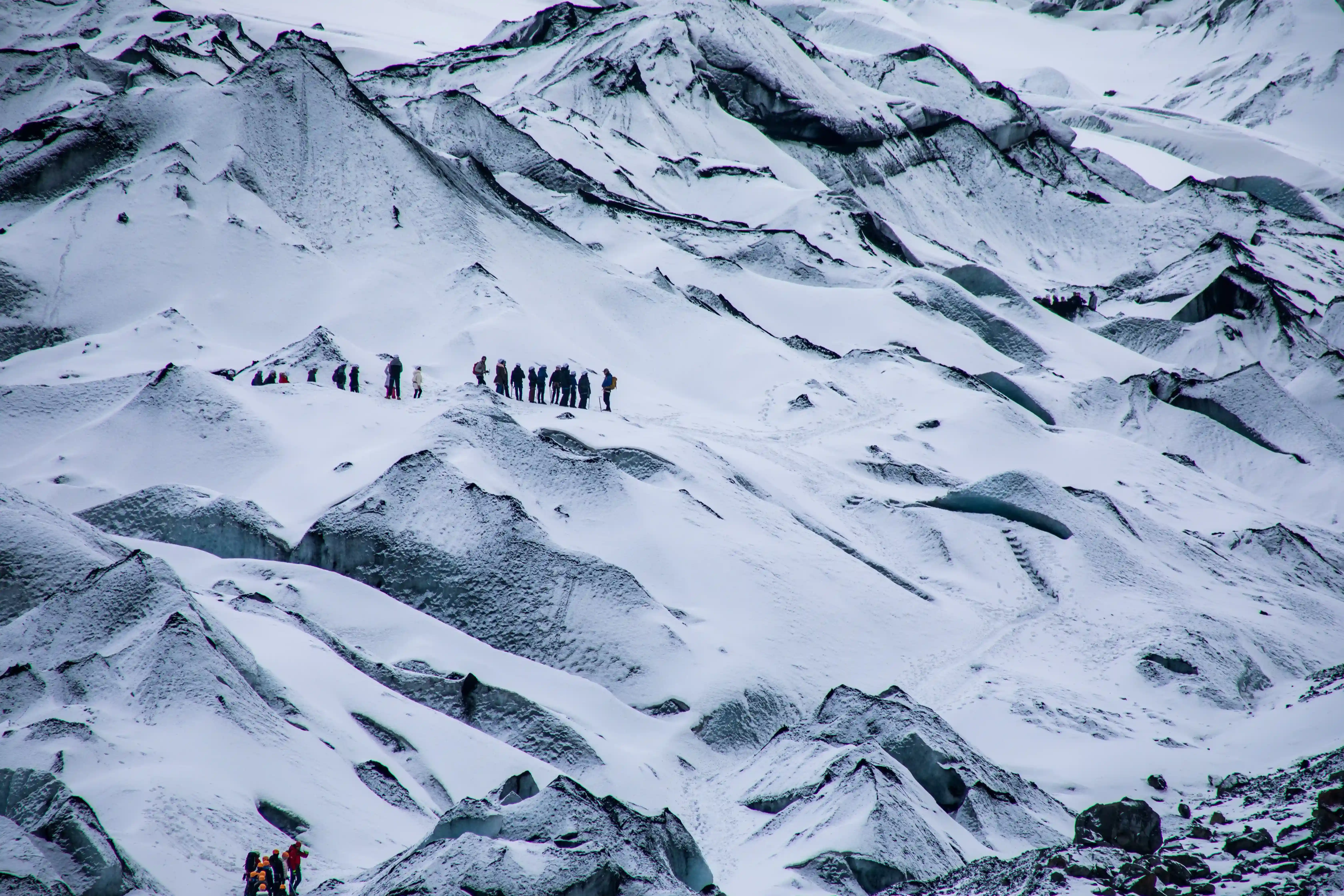
23-Day Makalu Base Camp via Sherpani Col and Amphu Lapcha Pass Itinerary

Tour Info

trip code

E-011

Starting Point/ End Point

Kathmandu

Accommodations

Lodge/ Tea House

Max Altitude

6143m

Duration

23 days

country

Nepal

Trip grade

Strenuous

Activities

Trekking

Best Season

Spring (March–May) and Autumn (September–November)

Overview

The Makalu Base Camp via Sherpani Col, West Col, and Amphu Lapcha Pass Trek is a strenuous trekking and mountaineering style trip which leads you from the Makalu region to the Everest region, crossing high altitude passes in the course of the journey. The trip is designed for skilled trekkers who have enough time and preparations to perform a lengthy and difficult Himalayan journey. The journey starts with your flight to Tumlingtar from Kathmandu and a subsequent drive to Num, after which you begin trekking to deeper parts of the Makalu region.

You will have a chance to walk through traditional mountain villages, dense forests, alpine valleys, glaciers and mountain landscapes until you reach Makalu Base Camp situated at an altitude of 4,870 meters. Having explored and acclimatized at the base camp, you head towards Hillary Base Camp and get prepared for the technical parts of the trip. Afterwards, you will be able to cross Sherpani Col and West Col at an altitude of more than 6,100 meters and descend to Baruntse High Camp. Your journey will continue to Amphu Lapcha Base Camp, and after crossing Amphu Lapcha Pass at 5,845 meters, you will enter the Everest region.

Moreover, the journey includes a possibility of exploring remote landscapes of Makalu-Barun National Park, admiring beautiful Himalayan mountains and enjoying various mountain landscapes during the trip. The route demands acclimatization, glacier skills, technical preparation and appropriate preparations for high-altitude conditions. Professional guides and support staff become especially crucial for high passes and glaciers parts of the trip.

All in all, the Makalu Base Camp via Sherpani Col, West Col, and Amphu Lapcha Pass Trek is a challenging mixture of remote trekking, high-altitude adventures, mountain landscapes and technical pass crossings. It can be considered a practical option for skilled adventurers who would like to go on an exciting journey connecting the Makalu and Everest regions through the Nepalese Himalayas.

Highlights

  • Flight from Kathmandu to Tumlingtar.
  • Road journey through the remote eastern Himalayan foothills to Num.
  • Trek through traditional mountain villages of the Makalu region.
  • Explore forests, alpine valleys, glaciers, and dramatic mountain landscapes.
  • Trek through the remote Makalu-Barun region.
  • Uphill trek through Seduwa, Tashi Gaun, and Khongma Danda.
  • Acclimatization at Khongma Danda before crossing the high passes.
  • Cross Shipton La, Keke La, and Tutu La.
  • Trek through the remote Barun Valley and alpine wilderness.
  • Explore Langmale Kharka and its high-altitude mountain scenery.
  • Reach Makalu Base Camp at an elevation of 4,870 meters.
  • Enjoy close-up views of Mount Makalu and surrounding Himalayan peaks.
  • Explore and acclimatize at Makalu Base Camp.
  • Trek to Hillary Base Camp at an elevation of 5,250 meters.
  • Receive glacier training and practice techniques before high-pass crossings.
  • Cross the challenging Sherpani Col at an elevation of 6,135 meters.
  • Cross the West Col at an elevation of 6,143 meters.
  • Descend through high-altitude terrain toward Baruntse High Camp.
  • Trek through remote glacial and mountain landscapes.
  • Reach Amphu Lapcha Base Camp at an elevation of 5,350 meters.
  • Cross the challenging Amphu Lapcha Pass at an elevation of 5,845 meters.
  • Descend into the Everest region through Chhukung.

Itinerary

Day 01: Arrival in Kathmandu

Upon your arrival at Tribhuvan International Airport, you will be received by our representative and taken to your hotel. On settling in, you may take some rest and rejuvenate yourself for your trip. If you feel energetic enough, you may stroll around the neighborhood and get a taste of the vibrant city of Kathmandu. Also, you will get to know your guide and learn about the Makalu Base Camp via Sherpani Col, West Col, and Amphu Lapcha Pass Trek. He will tell you about the overall route, the challenges of trekking at high altitudes, the acclimatization process, safety aspects of the expedition, and also about the equipment that you will need for the technical portions of the trek. The remaining part of the day will be yours for leisure and preparations.

  • Max Elevation: 1,400 meters (Kathmandu)
  • Travel Distance: 6 to 8 kilometers
  • Travel Hours: 20 to 30 minutes
  • Accommodation: 3 Star Standard Hotel
  • Meals: Welcome Dinner

Day 02: A Full Day Guided Tour and Trek Preparation in Kathmandu

After having breakfast at the hotel, you will be visiting Kathmandu Valley, which has plenty of cultural and historical sites, and at the same time make your final preparations for the trek. Private transportation and a local guide will be accompanying you, and it is easy to visit several world heritage sites without feeling rushed. The guide will give you explanations about the history, architecture, religion and cultural value of the visited places. You also have enough time to go back to the hotel and arrange your trekking equipment before you leave to begin the expedition.

A. Pashupatinath:
This Hindu temple complex is one of the most significant Hindu temples in Nepal. Pashupatinath temple is dedicated to Lord Shiva and located near the bank of the Bagmati river and features pagoda-style architecture. Although non-Hindus cannot enter the temple complex, you can see the entire temple complex and religious rituals from the east side of the river.

B. Boudhanath:
This Buddhist site is one of the most important places in Kathmandu, and it is distinguished by the huge white dome and golden spire. There are also prayer wheels, monasteries, shops and Tibetan Buddhist architecture around the stupa. You can observe Buddhist pilgrims walking around the stupa while using prayer wheels and praying.

C. Patan Durbar Square:
This square is located in Lalitpur and known for its architecture, artistic skill, temples, courtyards, and historic palaces. Almost all the structures here date back to the reign of the Malla kings and represent an impressive culture and architectural legacy of Kathmandu Valley.

D. Swayambhu Stupa/ Monkey Temple:
Swayambhunath Stupa is located on a hill and gives a view of the valley. It is one of the ancient Buddhist shrines in Nepal. Also, from the top of the hill, you can enjoy a panoramic view of Kathmandu Valley.

You will be returning to the hotel to make your final preparations for the trek. Your guide will help you with an equipment check to ensure that you have everything you need for the expedition. After all preparation you can relax during the evening, as tomorrow you will begin the trek to the Makalu region.

  • Max Elevation: 1,400 meters (Kathmandu)
  • Travel Distance: Approximately 25 to 30 kilometers
  • Travel Hours: 6 to 8 hours
  • Accommodation: 3 Star Standard Hotel
  • Meals: Breakfast

Day 03: Fly from Kathmandu (1,400 m) to Tumlingtar (440 m) and Drive to Num (1,560 m)

Your adventure starts with a flight from Kathmandu to Tumlingtar, which will be your point of departure to Num on foot. On this route you will travel along the route from Tumlingtar, heading towards Num, slowly moving away from low valleys and developed lands. During the trip, you will see different aspects of Nepal's landscape, including its hills, rivers, forests, terraces, and villages. Just by entering the Makalu zone, you can immediately notice that the environment has been transformed into a rural one. It is the Num village that acts as the access point for getting to the base camp of Makalu. After reaching the village, you can easily sort out your accommodation arrangements. All the preparations for the first trekking day will be arranged by your guide.

  • Max Elevation: 1,560 meters (Num)
  • Travel Distance: Approximately 30 to 35 kilometers by road
  • Travel Hours: Around 4 to 5 hours, including the flight
  • Accommodation: Tent Camp
  • Meals: Breakfast, Lunch, and Dinner

Day 04: Trek from Num to Seduwa (1,510 m)

After departure from Num, you head down to the Arun River and then start your gradual ascent to Seduwa. The path leads through green vegetation, terraced fields, little villages, and hills covered by forest. As the journey progresses, the area becomes greener compared to other areas you have already seen; there are subtropical plants on many hillsides around you. You will be able to visit some local villages and learn about traditional methods of farming during your trek. There are numerous ups and downs on the trail, and you get your first chance to explore the changing nature of the area. When approaching Seduwa, you can feel more calm around. Seduwa is an ancient mountain village and an essential destination on the way to Makalu Base Camp. Having arrived at the destination point, you will have enough time to rest.

  • Max Elevation: 1,510 meters (Seduwa)
  • Travel Distance: Approximately 6 to 7 kilometers
  • Travel Hours: 5 to 6 hours
  • Accommodation: Tent Camp
  • Meals: Breakfast, Lunch, and Dinner

Day 05: Trek from Seduwa to Tashi Gaun (2,070 m)

Today, your journey to Tashi Gaun is going to involve passing through a mixture of hill forests, terraced fields, and mountain settlements. This hike is going to be an ascending one since we will be moving away from the valleys of the Arun Valley region. Our path will go through sections that have different kinds of rhododendrons, bamboo, and Himalayan vegetation. You may also encounter some locals tending to their fields and taking care of their livestock. Today is going to be a very interesting start to discovering the different kinds of environments in the Makalu-Barun area. Tashi Gaun is going to be one of the last major villages before we reach the alpine region. Here, we will get a chance to see how the local community lives. After settling down in the village, we will spend the evening relaxing in the mountains.

  • Max Elevation: 2,070 meters (Tashi Gaun)
  • Travel Distance: Approximately 8 to 9 kilometers
  • Travel Hours: 5 to 6 hours
  • Accommodation: Tent Camp
  • Meals: Breakfast, Lunch, and Dinner

Day 06: Trek from Tashi Gaun to Khongma Danda (3,560 m)

The difficulty of your trip now rises as you will begin walking from Tashi Gaun to Khongma Danda. You will be traveling in a beautiful rhododendron and pine forest that will eventually turn into difficult terrain on the mountain. Vegetation becomes thinner while the surrounding scenery gets tougher with altitude gain. It is a great difference that you may observe on your way from the forest to the alpine zone. Khongma Danda is situated on the mountain ridge and offers beautiful views of the surrounding hills and Himalayas. Arriving here is one of the crucial stages of the expedition since all subsequent stages include several mountain passes. Your guide will encourage walking at a moderate pace and will be attentive to everyone for possible problems related to altitude.

  • Max Elevation: 3,560 meters (Khongma Danda)
  • Travel Distance: Approximately 7 to 8 kilometers
  • Travel Hours: 6 to 7 hours
  • Accommodation: Tent Camp
  • Meals: Breakfast, Lunch, and Dinner

Day 07: Acclimatization Day at Khongma Danda (3,560 m)

It is a very crucial acclimatization day at Khongma Danda. Today you do not head for a higher altitude but instead have the day to get used to the altitude conditions. The guide might even arrange for you to go for a short hike to the adjacent ridges, which would enable you to stay active and also improve your acclimatization. You get amazing views of the mountain ranges from the surrounding ridges as well as the transition from the forest valleys into the higher regions. Additionally, you also get to inspect your gear today and prepare for the high passes crossing. Your guide will brief you on the trail ahead of you, including the Shipton La, Keke La, and Tutu La trails. Then you head back to camp for the night.

  • Max Elevation: 3,560 meters (Khongma Danda)
  • Travel Distance: Approximately 3 to 5 kilometers
  • Travel Hours: 3 to 4 hours
  • Accommodation: Tent Camp
  • Meals: Breakfast, Lunch, and Dinner

Day 08: Cross Shipton La (4,216 m), Keke La (4,170 m), and Tutu La (4,080 m), then descend to Dobate (3,650 m)

This is one of the first significant difficulties during the expedition as you have to pass through several high passes while moving towards Makalu Base Camp. You will climb up to Shipton La and then pass through Keke La and Tutu La. The path will take you through some difficult mountain terrains, rocky patches, alpine vegetation, and open ridges, depending upon the season and weather. You will be able to have some great views of surrounding mountains and valleys from the high-altitude sections. After crossing the passes, the path will descend down to Dobate via forested areas. It is going to be a memorable trekking experience for you. Your guide will move at a safe speed and keep a watch on your party, as this high-altitude trek is essential to prepare for the upcoming passes. Completing the journey for the day, you will camp at Dobate for the night.

  • Max Elevation: 4,216 meters (Shipton La)
  • Travel Distance: Approximately 9 to 10 kilometers
  • Travel Hours: 7 to 8 hours
  • Accommodation: Tent Camp
  • Meals: Breakfast, Lunch, and Dinner

Day 09: Trek from Dobate to Yangri Kharka (3,570 m)

Once you leave Dobate, your next stop will be the deep valleys of Barun, and ultimately the point which is referred to as Yangri Kharka. The journey will involve going through the forested and rugged terrain in the vicinity of the Barun River. Gradually, the valley will open up to offer you stunning views of the snow-covered peaks of mountains and mountain faces. The peaceful setting with no presence of human settlements will obviously make it apparent to you how isolated the Makalu area is. In the course of making your journey towards Yangri Kharka, you will be offered the opportunity to see some waterfalls, cliffs, alpine vegetation, and many more unique features of the Makalu-Barun area. 

  • Max Elevation: 3,570 meters (Yangri Kharka)
  • Travel Distance: Approximately 9 to 10 kilometers
  • Travel Hours: 5 to 6 hours
  • Accommodation: Tent Camp
  • Meals: Breakfast, Lunch, and Dinner

Day 10: Trek from Yangri Kharka to Langmale Kharka (4,410 m)

This day is dedicated to traveling even farther into the upper Barun Valley toward Langmale Kharka. As the elevation grows, the forest cover decreases and the landscape changes to alpine. The trekking trail goes through the valley along rocks while enjoying the views of glaciers, snow-covered mountains, and the Himalayas. You feel even more isolated since you are far away from any human settlements. Langmale Kharka is a place where you can enjoy the best views of the landscape in the entire Makalu region due to its high mountain walls around the valley. As the altitude increases, you have to think about the proper pacing and hydration on your way to the Makalu base camp. Your guide will still take care of your health on your way to the final point of the trekking adventure. At Langmale Kharka, you may spend the night camping.

  • Max Elevation: 4,410 meters (Langmale Kharka)
  • Travel Distance: Approximately 8 to 9 kilometers
  • Travel Hours: 5 to 6 hours
  • Accommodation: Tent Camp
  • Meals: Breakfast, Lunch, and Dinner

Day 11: Trek from Langmale Kharka to Makalu Base Camp (4,870 m)

Today, it is time to take off on yet another adventure milestone in your life: Makalu Base Camp. This adventure requires you to climb up to the upper Barun Valley, which is famous for its amazing glaciers, rock features, and the stunning Himalayas. While making your way to reach the base camp, the figure of Mount Makalu in front of you grows and grows. There are plenty of things to see everywhere, and the region around you has beautiful glaciated peaks and mountain ranges, making it look spectacular. Definitely, reaching the base camp of Mount Makalu will be one of the most important parts of this trip. Once you reach the base camp, you will have a good time exploring the place while enjoying some magnificent views of Mount Makalu. 

  • Max Elevation: 4,870 meters (Makalu Base Camp)
  • Travel Distance: Approximately 9 to 10 kilometers
  • Travel Hours: 6 to 7 hours
  • Accommodation: Tent Camp
  • Meals: Breakfast, Lunch, and Dinner

Day 12: Exploration and Acclimatization at Makalu Base Camp (4,870 m)

This is the day of acclimatizing and moving around the base camp area of Makalu. The more you stay in the camp, the more chances there are for your body to get used to the altitude before going up to the next stages of the trek. You will have chances to explore the territory of the camp, enjoying the glaciers, rocks, and peaks of the highest mountains of the Makalu area. Mount Makalu will provide a perfect backdrop for your rest day. The guide will assess the condition of everybody and discuss the problems you will have to face, including the way to Hillary Base Camp and further high-altitude passes. You will get a chance to re-evaluate all your clothes, equipment, sleeping bags, and other necessary things. It is necessary to take a rest today because the further part of the route will be much more complicated. 

  • Max Elevation: 4,870 meters (Makalu Base Camp)
  • Travel Distance: Approximately 3 to 5 kilometers
  • Travel Hours: 3 to 4 hours
  • Accommodation: Tent Camp
  • Meals: Breakfast, Lunch, and Dinner

Day 13: Trek from Makalu Base Camp to Hillary Base Camp (5,250 m)

You will depart from Makalu Base Camp and proceed towards Hillary Base Camp, where you will find yourself in an even harsher environment of high altitude. Vegetation disappears from view, and there will be no other objects around you but glaciers, rocks, snow, and steep slopes of the mountains surrounding you. The trail offers magnificent views of the Himalayas in their vicinity and of remote glacial valleys. Hillary Base Camp is an important point before the technical section of the trip. Once you reach this point, your guide will organize the camp and begin with glacier and pass training. 

  • Max Elevation: 5,250 meters (Hillary Base Camp)
  • Travel Distance: Approximately 8 to 9 kilometers
  • Travel Hours: 5 to 6 hours
  • Accommodation: Tent Camp
  • Meals: Breakfast, Lunch, and Dinner

Day 14: Acclimatization, Glacier Practice, and Technical Training at Hillary Base Camp (5,250 m)

On this day, we plan to spend time getting acclimated, technically prepared, and practicing glacier skills at Hillary Base Camp. The importance of today lies in the fact that we shall be encountering some of the most difficult terrains during the later stages of this journey. Our well-trained guides will give us practical lessons in using crampons, harnesses, ropes, ice axes, and other technical gear. We shall practice movement over snow and ice and gain skills which can be needed in case of crossings over high passes. Additionally, we will also learn about how to navigate through the glaciers and how to follow the rope system when it is needed. In addition to this, we will spend time resting and adjusting to high altitudes. Our guides will make an assessment of weather conditions and the physical condition of the team members prior to the next stage of our expedition.

  • Max Elevation: 5,250 meters (Hillary Base Camp)
  • Travel Distance: Approximately 2 to 4 kilometers
  • Travel Hours: 2 to 4 hours
  • Accommodation: Tent Camp
  • Meals: Breakfast, Lunch, and Dinner

Day 15: Trek from Hillary Base Camp to Sherpani Col High Camp

Once you finish your acclimatization and technical training at Hillary Base Camp, you will start moving up towards Sherpani Col High Camp. Now you have come to the path that is characterized by the harsh and difficult terrain, which is full of glaciers, snow, ice, rocks, and mountains. Since the altitude increases, you should be prepared for thin air and move slowly and steadily. Your guide and your technical climbing team will be watching your condition all the way up and helping you with crampons, harnesses, ropes, ice axes, and other gear. The travel up to High Camp is intentionally made to be shorter than the next day's pass crossing, which means that you will arrive at your destination camp and have some time to sleep and prepare for tomorrow's early start. Once you get to Sherpani Col High Camp, your team will inspect the gear and get ready for crossing Sherpani Col and West Col the next day.

  • Max Elevation: Sherpani Col High Camp
  • Travel Distance: Approximately 4 to 6 kilometers
  • Travel Hours: 4 to 6 hours
  • Accommodation: Tent Camp
  • Meals: Breakfast, Lunch, and Dinner

Day 16: Cross Sherpani Col (6,135 m) and West Col (6,143 m), then descend to Baruntse High Camp (5,450 m)

Today marks one of the toughest days during the entire expedition. You are going to start ascending from Sherpani Col High Camp in the morning because snow and glacier conditions will be more favorable. The path is going to consist of tough glaciated mountain terrain until you get to Sherpani Col located at 6,135 meters. According to the conditions, fixed ropes may be used as well as other technical equipment, with climbing guides helping out along the way. Once you are done with crossing Sherpani Col, you will move further to West Col, which is located at 6,143 meters and serves as the highest point of the whole expedition. It requires moving carefully, using mountaineering gear correctly, and coordinating actions with guides. Once you cross both high passes, it is time to descend to Baruntse High Camp. Although the height will become gradually lower, the terrain will still remain very tough. Upon reaching camp, you will have some time to relax and prepare for the next part of the expedition.

  • Max Elevation: 6,143 meters (West Col)
  • Travel Distance: Approximately 8 to 10 kilometers
  • Travel Hours: 9 to 11 hours
  • Accommodation: Tent Camp
  • Meals: Breakfast, Lunch, and Dinner

Day 17: Trek from Baruntse High Camp to Amphu Lapcha Base Camp (5,350 m)

Following the tough climb up Sherpani Col and West Col, today marks the day when you can move to your next objective and at the same time give your body some rest. You will start from Baruntse High Camp and move to the tough highlands to arrive at Amphu Lapcha Base Camp. The journey that you will take will pass through areas characterized by rocks, snow, ice, and mountains, and glaciers are found in such areas. Along the way, you will get amazing views of the mountains in the Himalayan Range. The journey will gradually take you closer to Amphu Lapcha, where everything will still be remote, and there won't be any settlements around. Your trekking and climbing team will keep a steady pace while also keeping track of the altitude issues among the members after yesterday's experience of passing the high pass. After arrival at Amphu Lapcha Base Camp, the team will make camp and prepare all the equipment for the next part of the journey. In addition, your guide will inform you about the route over Amphu Lapcha Pass.

  • Max Elevation: 5,450 meters (Baruntse High Camp)
  • Travel Distance: Approximately 7 to 8 kilometers
  • Travel Hours: 5 to 6 hours
  • Accommodation: Tent Camp
  • Meals: Breakfast, Lunch, and Dinner

Day 18: Cross Amphu Lapcha Pass (5,845 m) and Trek to Chhukung (4,730 m)

For today's trekking journey, you will have to cross a very challenging pass that separates the regions of Makalu and Everest, called Amphu Lapcha Pass. The climb will have to deal with hilly terrain in the form of snow, ice, and rocks, which can vary depending upon the season and climatic changes. Your knowledge about the technique of climbing will help you pass this barrier along with the assistance of your experienced guides. During the journey, you will be able to enjoy wonderful views of the Amphu Lapcha Pass, which has the magnificent Himalayan peaks, glaciers, and valleys. Passing through Amphu Lapcha Pass, you will go on to the descent to the region of Everest, Chhukung. As you begin to move past the high pass, you will notice the changing landscape and environment of the region as you enter the Khumbu region of Everest.

  • Max Elevation: 5,845 meters (Amphu Lapcha Pass)
  • Travel Distance: Approximately 9 to 10 kilometers
  • Travel Hours: 8 to 10 hours
  • Accommodation: Teahouse or Lodge
  • Meals: Breakfast, Lunch, and Dinner

Day 19: Trek from Chhukung to Pangboche (3,985 m)

In today’s lesson, you will carry on your adventure inside the Everest region by descending from Chhukhung to Pangboche. You will be traveling via the beautiful valley of Imja, which is home to several Sherpa villages situated in the beautiful Himalayan region. As you start to come down, the environment will become more lush and hospitable, with Alpine flora coming back along the trekking route. Some sites along the trail include the Buddhist prayer flags, mani walls, chortens and traditional stone houses that represent the rich cultural heritage of the Khumbu region. Pangboche village is one of the oldest and most culturally rich villages of the Everest region, offering you a taste of traditional mountain life. You will be surrounded by the amazing views of the Himalayan mountains.

  • Max Elevation: 4,730 meters (Chhukung)
  • Travel Distance: Approximately 10 to 11 kilometers
  • Travel Hours: 5 to 6 hours
  • Accommodation: Teahouse or Lodge
  • Meals: Breakfast, Lunch, and Dinner

Day 20: Trek from Pangboche to Namche Bazaar (3,440 m)

On this day, you will be proceeding to Namche Bazaar through the trails that have already been marked in the Khumbu region. The trail takes you through Sherpa villages, forests, suspension bridges, and viewpoints overlooking the Himalayas around. During your descent in the Dudh Koshi valley, you will be using the well-marked trails of the Everest region. On the way, you will come across the religious sites of the Sherpa Buddhist culture such as mani stones, prayer flags, monasteries, chortens, and so forth. Having been trekking in the wilderness of the Makalu region for many days now, the bustling environment of Namche Bazaar will offer you a new experience altogether. Namche Bazaar is the primary center for commerce in Khumbu and is surrounded by beautiful mountains on all sides. On arrival, one can walk around town or simply take a seat to unwind.

  • Max Elevation: 3,985 meters (Pangboche)
  • Travel Distance: Approximately 13 to 14 kilometers
  • Travel Hours: 6 to 7 hours
  • Accommodation: Teahouse or Lodge
  • Meals: Breakfast, Lunch, and Dinner

Day 21: Trek from Namche Bazaar to Lukla (2,860 m)

This is your final major trekking day as you hike all the way down to Lukla from Namche Bazaar. Your trail winds its way down the valley along the same path you are accustomed to going along with the Sherpa villages, the trees, the suspension bridges and the mountain landscape. As you head down towards Lukla, you will find that the environment around you is becoming greener and the height is becoming lower. It is at this point that you can savor the magnificent trekking experience that you have had right from the distant land of Makalu all the way to the base camp of Makalu, passing through the tough passes of Sherpani Col, West Col and Amphu Lapcha Pass.

  • Max Elevation: 3,440 meters (Namche Bazaar)
  • Travel Distance: Approximately 18 to 20 kilometers
  • Travel Hours: 7 to 8 hours
  • Accommodation: Teahouse or Lodge
  • Meals: Breakfast, Lunch, and Dinner

Day 22: Fly from Lukla (2,860 m) to Kathmandu (1,400 m)

Today, you will have an amazing flight from Lukla to Kathmandu, which will conclude your trekking in the Himalayan region. This will provide you with another chance of viewing the mountains and valleys, but this time from the air. After reaching Kathmandu, you will be taken to your hotel, where you will stay until the end of the day. You can freely roam around the city and do some shopping for gifts and also unwind after such a hard trekking journey. Also, you will be able to meet with the trekking team and share your experience of this great trekking adventure. Your last night in Nepal will be spent at the hotel in Kathmandu.

  • Max Elevation: 2,860 meters (Lukla)
  • Travel Distance: Approximately 138 kilometers by flight
  • Travel Hours: 35 to 40 minutes by flight
  • Accommodation: 3 Star Standard Hotel
  • Meals: Breakfast

Day 23: Transfer to Tribhuvan International Airport for Final Departure

The incredible trek to Makalu Base Camp via Sherpani Col, West Col, and Amphu Lapcha Pass will conclude today. Depending on your flight schedule, you could have some additional time to spare in Kathmandu for leisure or sightseeing in the city before you leave for the airport. Our representative will pick you up from the hotel and take you to Tribhuvan International Airport, from where you will depart. As you depart from Nepal, you will leave behind the memories of the pristine Makalu-Barun Valley, the magnificent Himalayan mountains, traditional mountain settlements, glaciers, high-altitude terrain, and the crossings over the Sherpani Col, West Col, and Amphu Lapcha Pass.

  • Max Elevation: 1,400 meters (Kathmandu)
  • Travel Distance: Approximately 6 to 8 kilometers
  • Travel Hours: 20 to 30 minutes
  • Meals: Breakfast

What's included

  • Airport pickup and drop-off by private vehicle
  • 3-star standard hotel accommodation in Kathmandu
  • Tent accommodation throughout the trekking sections wherever camping is possible
  • Teahouse or lodge accommodation where tent camping is not practical or available
  • All meals during the trek, including breakfast, lunch, and dinner
  • Welcome dinner in Kathmandu
  • Flight from Kathmandu to Tumlingtar
  • Ground transportation from Tumlingtar to Num
  • Flight from Lukla to Kathmandu
  • Experienced and licensed trekking guide
  • Experienced high-altitude and technical guides for the high-pass sections
  • Porter service
  • Makalu-Barun National Park entry permit
  • Required trekking and conservation permits
  • TIMS card, if required
  • Tent, camping equipment, kitchen equipment, dining equipment, and other camping accessories
  • Equipment required for glacier and high-pass sections
  • Glacier section practice from Hillary Base Camp
  • Sleeping bag and down jacket
  • First aid kit and pulse oximeter
  • Government taxes and applicable service charges

What's excluded

  • International airfare to and from Nepal
  • Nepal visa fees
  • Travel and medical insurance
  • Emergency helicopter evacuation
  • Personal medical costs and medications
  • Food and beverages in Kathmandu, excluding the complimentary welcome dinner
  • Personal climbing and trekking equipment
  • Drinks, water, snacks, and other personal expenses
  • Wi-Fi, hot showers, laundry, and charging facilities during the trek
  • Tips and gratuities for guides, porters, and other supporting staff
  • Accommodation and transportation expenses due to flight delays or cancellations, bad weather, landslides, strikes, or other unforeseeable events
  • Expenses related to changes in the itinerary due to health reasons, weather, political situations, or other natural calamities
  • All services and expenses not mentioned under the cost inclusions

Packing List

If you are considering the Makalu Base Camp via Sherpani Col, West Col & Amphu Lapcha Pass Trek, having the correct gear will ensure your safety and comfort in the unpredictable conditions of the Himalayas. The expedition involves long periods at high altitude, camping in tents, glaciated terrain, challenging trails, and crossing high-altitude passes that exceed 6,000 meters. Therefore, you should be well prepared with appropriate clothing, technical equipment, camping gear, and personal essentials.

Below is a recommended packing list for the trek.

Head

  • Warm insulated beanie
  • Fleece or wool headband
  • Sun hat or wide-brimmed trekking hat
  • Neck gaiter or buff
  • Balaclava or face covering
  • High-SPF sunscreen
  • UV-protected sunglasses
  • Category 4 glacier sunglasses
  • Ski or glacier goggles
  • Lip balm with SPF
  • Lightweight headlamp with spare batteries

Hands

  • Lightweight liner gloves
  • Fleece or wool gloves
  • Insulated waterproof gloves
  • Heavy-duty expedition mittens
  • Hand warmers

Upper Body

  • Moisture-wicking base layers
  • Thermal inner layers
  • Quick-drying trekking shirts
  • Long-sleeved trekking shirts
  • Fleece jacket
  • Insulated down jacket
  • Waterproof and windproof shell jacket
  • Lightweight puffy jacket
  • Waterproof outer shell
  • Expedition-weight insulated jacket for high-altitude sections

Lower Body

  • Thermal innerwear
  • Moisture-wicking trekking underwear
  • Quick-drying trekking trousers
  • Fleece or insulated trousers
  • Waterproof and windproof shell pants
  • Full-length trekking pants
  • Warm insulated pants for high-altitude sections
  • Comfortable lightweight pants for lower elevations

Footwear

  • Durable waterproof trekking boots
  • Insulated high-altitude mountaineering boots
  • Lightweight camp shoes or sandals
  • Moisture-wicking trekking socks
  • Warm wool or thermal socks
  • Spare pairs of trekking socks
  • Gaiters
  • Crampon-compatible footwear suitable for technical sections

Camping and Sleeping Gear

  • Four-season sleeping bag suitable for extreme cold
  • Sleeping bag liner
  • Insulated sleeping mat
  • Expedition-quality tent
  • Tent footprint or groundsheet
  • Small pillow or inflatable pillow
  • Earplugs
  • Sleeping clothes

Technical Climbing Gear

  • Mountaineering harness
  • Mountaineering helmet
  • Crampons
  • Ice axe
  • Prusik loops
  • Carabiners
  • Ascender or Jumar
  • Descender/rappel device
  • Climbing sling
  • Locking carabiners
  • Personal climbing rope or safety equipment, as advised by the expedition guide
  • Technical glacier-travel equipment required for the high passes

Toiletries

  • Toothbrush and toothpaste
  • Biodegradable soap
  • Toilet paper
  • Quick-dry towel
  • Hand sanitizer
  • Wet wipes
  • Small shampoo bottle
  • Moisturizer
  • Lip balm with SPF
  • Sunscreen
  • Personal hygiene products
  • Small toiletry bag

Accessories

  • Large expedition duffle bag
  • Small trekking backpack or daypack
  • Water bottles or hydration bladder
  • Water purification tablets or filter
  • Lightweight trekking poles
  • Dry bags or waterproof packing bags
  • Duffel bag rain cover
  • Pack rain cover
  • Thermos or insulated water bottle
  • Power bank
  • Portable solar charger, if required
  • Travel adapter
  • Small repair and gear-maintenance kit

First Aid Kit

  • Personal prescription medicines
  • Altitude sickness medication, as prescribed
  • Painkillers
  • Antiseptic wipes
  • Bandages
  • Blister treatment
  • Gauze and medical tape
  • Anti-diarrhea medication
  • Oral rehydration salts
  • Basic cold and flu medication
  • Personal medical supplies
  • Any medication specifically recommended by your doctor

Miscellaneous Items

  • Passport and copies of important documents
  • Camera or phone
  • Extra batteries
  • Power banks
  • Memory cards
  • Binoculars
  • Waterproof document pouch
  • Small notebook and pen
  • Zip-lock bags
  • Snacks, energy bars, and chocolates
  • Book or entertainment for rest days
  • Waste bags for personal rubbish

Specific Gear for Women

Women undertaking this demanding expedition should carry personal hygiene and clothing items that provide comfort and convenience throughout the extended camping sections. The following items are recommended:

  • Sports bras
  • Comfortable undergarments
  • Thermal innerwear
  • Sanitary pads
  • Tampons or menstrual cups
  • Personal hygiene products
  • Travel-size shampoo
  • Moisturizer and skin cleanser
  • High-SPF sunscreen
  • Fleece headband
  • Comfortable leggings
  • Quick-drying underwear
  • Small personal hygiene pouch

Frequently Asked Questions

Is the trek to Makalu Base Camp through Sherpani Col, West Col, and Amphu Lapcha Pass suitable for beginners?

Certainly not. It is a difficult mountain climb at high altitude, which includes glacier crossing, technical passages, and altitudes greater than 6,000 m. Experience in trekking and mountaineering at high altitude and fitness are recommended.

What is the highest altitude along the trail?

The West Col at 6,143 meters is the highest point in the trek route. The other peaks to be crossed are the Sherpani Col at 6,135 meters and the Amphu Lapcha Pass at 5,845 meters.

Is any experience in mountaineering necessary for this trek?

Yes. It is highly recommended. This trek involves glacial travel, snow and ice climbing, and passes across high-altitude passes which require skill and appropriate equipment.

Is camping necessary for the trek to the base camp of Makalu?

Yes, since the trail crosses through far-flung and high-altitude zones, where accommodation facilities are either scarce or non-existent, camping in tents is done whenever possible in locations where there is availability of teahouse/lodging facilities. 

What kind of technical equipment is required?

Technical equipment may include crampons, mountaineering boots, harnesses, helmets, ice axes, carabiners, ascenders, descenders, slings, and other glacier-travel equipment. Make sure your trekking or climbing operator verifies what equipment will be provided and what equipment you need to bring yourself.

What permits would we need for this trek?

It would be important to obtain permits for the Makalu-Barun National Park and the Everest region. It would perhaps also be necessary to have permits for the higher elevations. Another permit that would be required is the TIMS card.

When is the ideal time for the trek?

The ideal season to do this trip is either spring (from March to May) or autumn (from September to November), since the weather conditions are relatively stable and visibility of the mountain range is good.

What is the level of difficulty of the trekking?

This trekking is extremely difficult, as it involves high altitudes, remote places, long trekking days, glacier zones, and technical pass passages.

Is there acclimatization in the itinerary?

Yes. In the itinerary, two acclimatization days are planned – one in Khongma Danda and one in Makalu Base Camp, as well as one acclimatization and technical training day in Hillary Base Camp. This rest period will help you acclimatize to increasing altitudes before passing harder sections of the trekking.

Can I go without a guide?

We don't recommend doing this trek without a guide. The trek passes through remote wilderness, glacier areas, high-altitude passes and has technical parts, where route-finding and mountaineering knowledge and skills are needed.

User Review