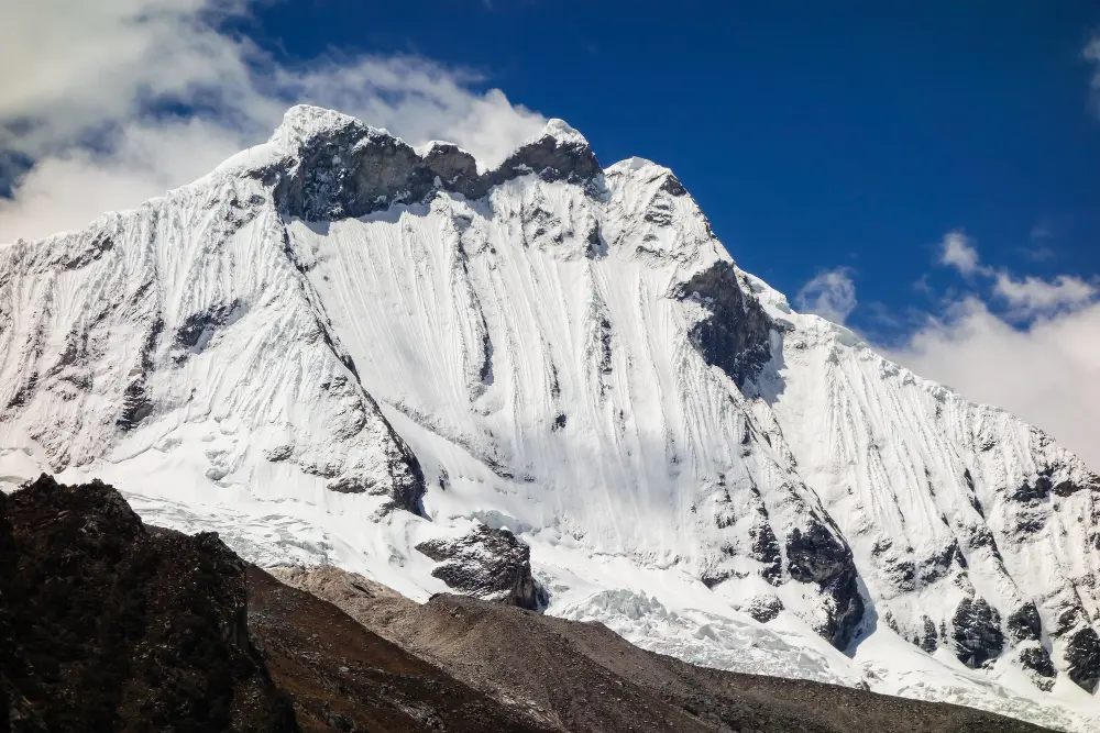
Triangle Peak Summit - 24 Days

Tour Info

trip code

EN-28

Starting Point/ End Point

Kathmandu

Accommodations

Lodge/ Tea House

Max Altitude

6461m (Mera Peak Summit)

Duration

23 days

country

Nepal

Trip grade

Extreme

Activities

Climbing

Best Season

February, March, April, May, June, September, October, November and December

Overview

The Three Peaks Climbing is an Himalayan adventure that brings trekking and mountaineering together in one journey. Three famous peaks, Mera Peak (6,461m), Island Peak (6,189m), and Lobuche East Peak (6,119m), can be experienced very closely. You can also get the complete Everest region experience. With the highest trekking peak in Nepal, known for its wide trails and incredible views of Everest, Makalu, and Lhotse, this trek begins with Mera Pea. After Mera, the trail continues to Island Peak, where steeper climbs and you have to follow the  basic technical skills. Finally, Lobuche East with stunning close-up views of the world’s tallest mountains.

Details

The Three Peaks Climbing Expedition is perfect for travelers who want more than just a trek in the Everest region. This journey is for you to experience high-altitude trekking, mountaineering, and himalayan viewpoints all in one trip. Instead of climbing a single peak, you gradually progress through Mera Peak, Island Peak, and Lobuche East.

Another reason to choose this triangle peak summit is the variety it offers. You trek through remote valleys, cross glaciers, stay in traditional teahouses, and finally stand on three Himalayan summits. Along the way, you also reach Everest Base Camp and Kala Patthar, making the experience complete and rewarding. This trek is perfect for you, if you want to complete a challenging trek without extreme technical difficulty.

Highlights

  • Climb three famous Himalayan peaks over 6,000 meters; Mera Peak, Island Peak, and Lobuche East in one single journey.

  • Stand on the summit of Mera Peak, the highest trekking peak in Nepal, and enjoy wide Himalayan views.

  • Witness close-up views of the world’s five highest mountains, including Mount Everest, Kanchenjunga, Makalu, Lhotse, and Cho Oyu.

  • Follow semi-technical climbing routes that are ideal for beginner climbers to learn and improve basic mountaineering skills.

  • Cross the challenging Amphu Labtsa Pass, one of the most technical and adventurous passes in the Himalayas.

  • Walk through the dramatic landscapes of the Dudh Koshi and Hinku (Honku) valleys, surrounded by glaciers and high peaks.

  • Explore two beautiful national parks: Sagarmatha National Park and Makalu Barun National Park.

  • Experience warm Sherpa culture, local traditions, and genuine hospitality in traditional mountain villages.

Itinerary

Day 01:  Arrival in Kathmandu & Transfer to Hotel

Our representative welcomes you at Tribhuvan International Airport and transfers you to your hotel in Kathmandu. After reaching the hotel, our staff assists you with the check-in process. Once you settle in your hotel room, you can take some time to rest and recover from your journey. You visit our office if you would like to know more details and information about the upcoming trip.

  • Max Elevation: 1350 meters (Kathmandu)

  • Travel Distance: 6 to 8 kilometers

  • Travel Hours: 20 to 30 minutes

  • Accommodation: 3 Star Hotel

  • Meals: Dinner

Day 02: Full Day Sightseeing Tour

After breakfast, if you did not have the pre-trip briefing on the day before, you will hold the briefing on this day. Following this, you start your sightseeing trip at around 8 am. The trip is done on a private vehicle and is conducted with the aid of a tour guide. During this sightseeing tourism trip, you shall visit the following heritage sites:

A. Pashupatinath Temple (UNESCO): Major Hindu temple dedicated to Lord Shiva, located on the banks of the Bagmati River. The temple is viewed from the eastern bank, as entry is restricted to Hindus. 

B. Boudhanath Stupa (UNESCO): One of the holiest Buddhist sites in Kathmandu, built in the 5th century. Known for its massive stupa, Buddha’s all-seeing eyes, and prayer wheel circumambulation.

C. Swayambhunath Stupa (Monkey Temple): Hilltop Buddhist stupa offering panoramic views of Kathmandu Valley. Popularly called Monkey Temple due to the resident monkeys.

D. Kathmandu Durbar Square (UNESCO): Historic palace complex of the Malla kings featuring temples, courtyards, museums, and a unique 17th-century inscription in 15 languages.

E. Patan Durbar Square (UNESCO): Located in Lalitpur, known for refined Newari architecture from the Malla era and a rich artistic heritage. Following this tour, you head back to your hotel for an overnight stay. 

  • Max Elevation: 1,450 meters (Swayambhunath Stupa)

  • Travel Distance: 25 to 30 kilometers (total driving between sites)

  • Travel Hours: 6 to 7 hours

  • Accommodation: 3-star standard Hotel 

  • Meal:  Breakfast, Lunch, Dinner

Day 03: Fly to Lukla (2840m) and Trek to Chhutang (2800m)

Very early in the morning, you take a short flight 30 minutes to Lukla. Now, you start your trek from Lukla to Chhutang, which takes you around 4 to 5 hours to complete. Meet the local climbing crew, begin your trek and continue moving ahead, with views of Mount Kongde Ri. The trail heads southeast above the Dudh Koshi River, passing small villages and shaded forest paths for about 2 to 3 hours. After reaching the Makalu Barun Conservation Area checkpost and completing registration. Continue trekking for another 2 hours, crossing small rivers and a Buddhist gompa before arriving at Chhutang, where you get clear views of the Kalo Himal Ridge.

  • Flight Duration: 30 minutes

  • Max Elevation: 2840 meters (Lukla)

  • Travel Distance: 6 to 7 kilometers

  • Travel Hours: 4 to 5 hours

  • Accommodation: Tea house /Lodge

  • Meals: Breakfast, Lunch, and Dinner

Day 04: Trek from Chhutang to Tulikharka (4100m)

Trekking from Chhutang to Tulikharka is challenging, with a steady climb toward the Zwatra La Pass (4,600m). It takes you around 5 to 6 hours to reach Tulikharka from Chhutang. The trail first ascends over the Kalo Himal Ridge and slowly enters the Hinku Valley. After walking for about 2 to 3 hours, you pass through Kharitang (3,900m) and continue climbing on an old mountain trail. From the pass, the trek towards downhill is less than an hour which leads you to Thuli Kharka, where you rest for the night after covering around 7 km.

  • Max Elevation: 4600 meters (Zwatra La Pass)

  • Travel Distance: 6 to 7 kilometers

  • Travel Hours: 5 to 6 hours

  • Accommodation: Tea house /Lodge

  • Meals: Breakfast, Lunch, and Dinner

Day 05: Trek from Tuli kharka to Kothe (3580m)

The trek begins by following the hillside of Tashi Dingma above the Hinku Valley. For the first 2 to 3 hours, the trail descends steeply while offering views of the south face of Mera Peak as you head toward Tashi Ongma. The path then moves gently through pine, rhododendron, and bamboo forests along a ridge beside the Hinku River. After walking around 9 km in total over 6 to 7 hours, you reach Kothe, also known as Mosom Kharka. This small area where you can rest and from here you can get a clear view of Peak 43 and Kusum Kanguru.

  • Max Elevation: 3950 meters (Thangnak)

  • Travel Distance: 8 to 9 kilometers

  • Travel Hours: 6 to 7 hours

  • Accommodation: Tea house /Lodge

  • Meals: Breakfast, Lunch, and Dinner

Day 06: Trek from Kothe to Thangnak (4326m)

By following the stony walls of the Hinku Valley, and with clear views of Kyashar and Kusum Kanguru, you have to reach Thangnak from Kothe. The trail gradually ascends along the river, passing rocky sections, and the grassy yak pastures of Hinku Drangka. After crossing Gondishung pasture, the path continues deeper into the valley. Along the way, you see the historic Lungsumgba Monastery, which is over 200 years old. After about 4 to 5 hours and 8 km of walking, you reach Thangnak, a summer grazing area with small lodges, surrounded by spectacular views of Charpate Himal, Thamserku, Mera, Kusum Kanguru, and Peak 43.

  • Max Elevation: 4350 meters (above Thangnak, Hinku Valley)

  • Travel Distance: 7 to 8 kilometers

  • Travel Hours: 5 to 6 hours

  • Accommodation: Tea house /Lodge

  • Meals: Breakfast, Lunch, and Dinner

Day 07: Trek from Thangnak to Khare (5000m)

Leaving Thangnak, you trek east, moving to higher altitude for about half an hour toward Sabai Tsho Glacial Lake (4,463m). The trail then continues for around two hours along the lateral moraine of Dig Glacier. You walk through the wide yak pastures of Dig Kharka and climb across the edge walls toward the Hinku Nup and Shar glaciers. In the final hour, the path crosses a stream and passes boulder-strewn terrain before reaching Khare.

  • Max Elevation: 4,463meters (Sabai Tsho Glacial Lake)

  • Travel Distance: 4 to 5 kilometers

  • Travel Hours: 3 hours

  • Accommodation: Tea house /Lodge

  • Meals: Breakfast, Lunch, and Dinner

Day 08: Acclimatization day

Acclimatization day is very important for you to help your body adjust to the high altitude. You can explore the area around Khare and enjoy the beautiful Himalayan scenery. After that, you also have a session with your climbing guide to learn basic ice climbing skills. The guide will teach you how to use crampons, ropes, ice axes, harnesses, and other climbing gear. You can practice these skills safely on the nearby glacier, preparing yourself for the upcoming climbs.

  • Max Elevation: 5,100 meters (practice hike above Khare)

  • Travel Distance: 2 to 3 kilometers

  • Travel Hours:  3 hours

  • Accommodation: Tea house /Lodge

  • Meals: Breakfast, Lunch, and Dinner

Day 09: Trek to Mera High Camp (5700m)

You move toward the High Camp of Mera Summit from Khare, the first peak of the triangle peak summit. It takes you 4 to 5 hours to reach Mera High Camp from Khare. The trail climbs along the rocky path of Mera La Pass and then follows gentle snow slopes. You cross small crevasses safely and continue up slightly steeper snow sections. After a few hours of trekking, you reach Mera High Camp. From here, you can enjoy amazing views of Everest, Makalu, Cho Oyu, Nuptse, Lhotse, Chamlang, and Baruntse.

  • Max Elevation: 5,415 meters (Mera La Pass)

  • Travel Distance: 5 kilometers

  • Travel Hours: 4 to 5 hours

  • Accommodation: Tent/Camping

  • Meals: Breakfast, Lunch and Dinner

Day 10: Summit Mera peak (6461m), Trek to Kongma Dingma (4850m)

It takes you around 11 to 12 hours, as you are going to summit Mera Peak and then head towards Kongma Dingma. You wake up very early in the dark and start the climb after warming up with hot tea or coffee. The initial climb over Mera Glacier is straightforward, and near the summit, you use fixed ropes for safety as you make the final push. Standing on Mera Peak, enjoy breathtaking views of Everest, Cho Oyu, Kanchenjunga, Lhotse, Makalu, Nuptse, Chamlang, and Lobuche. After celebrating, you will descend through High Camp, Base Camp, and Khare, continuing east to reach Kongma Dingma.

  • Max Elevation: 6,461 meters (Mera Peak Summit)

  • Travel Distance: 18 to 20 kilometers

  • Travel Hours: 10 to 11 hours

  • Accommodation: Tent

  • Meals: Breakfast, Lunch and Dinner

Day 11: Rest Day in Kongma

After a challenging Mera Summit climb, a rest day in Kongma is very helpful for you to help your body recover. You take a short hike around the area for about 1 to 2 hours, covering 2 to 3 km, to stretch your legs and enjoy the beautiful surroundings. The day is perfect for relaxing, hydrating, and preparing for the next day. Or, you also practice light climbing techniques or simply enjoy the stunning views of nearby peaks while resting in the peaceful environment.

  • Max Elevation: 4,850 meters (Kongma Dingma area)

  • Travel Distance: 2 to 3 kilometers

  • Travel Hours: 1 to 2 hours

  • Accommodation: Tent

  • Meals: Breakfast, Lunch and Dinner

Day 12: Trek from Kongma to Seto Pokhari (5035m)

By continuing the trek from Kongma to Seto Pokhari, you have to trek around 5 to 6 hours to reach there. You trek across the remote Honku Valley to reach the White Lake, also known as Seto Pokhari. The trail passes through wide green yak pastures with Baruntse visible in the distance. Enjoying the calm and peaceful surroundings, you follow the Honku Glacial River. Along the way,  Lhotse and Everest become visible as you get closer to Seto Pokhari.

  • Max Elevation: 5,035 meters (Seto Pokhari)

  • Travel Distance:  8 kilometers

  • Travel Hours: 7 to 8 hours

  • Accommodation: Tent

  • Meals: Breakfast, Lunch and Dinner

Day 13: Trek to south Amphu Labcha Base Camp (5650m)

To reach South Amphu Labcha Base Camp from Seto Pokhari, takes you around 5 to 6 hours. As you move forward, you can enjoy the close-up views of Mount Chamlang and Mount Everest. The trail passes through the Honku Khola, Honku Glacier, and Panch Pokhari. After covering around 7 to 8 km, you reach Amphu Labcha South Camp, where the team set up a comfortable campsite, and gets ready for tomorrow’s climb.

  • Max Elevation: 5,200 meters (highest point between Seto Pokhari and Amphu Labcha Base Camp)

  • Travel Distance:  7 to 8 kilometers

  • Travel Hours:  5 to 6 hours 

  • Accommodation: Tent

  • Meals: Breakfast, Lunch and Dinner

Day 14: Trek to Chhukung (4750m) Via Amphu Labcha Pass

Trek to Chhukung via Amphu Labcha Pass is the toughest day on the triangle peak summit. You start from Amphu Labcha High Camp and cross steep rock and ice sections on the glacier for about two hours, using climbing ropes and a jumar on two railing sections. The trail then becomes gentler as you reach the Amphu Labcha Pass. From here, you get the clear views of Chamlang, Lhotse, Mera Peak, Cho Oyu, Makalu, Island Peak, and Everest. After about 4 hours of descent on fixed lines, you continue east past Imja and Lhotse glaciers to reach Chhukung, covering around 12 km in 9 to 10 hours.

  • Max Elevation: 5,780 meters (Amphu Labcha Pass)

  • Travel Distance:  11 to 12 kilometers

  • Travel Hours:  9 to 10 hours

  • Accommodation: Tea house

  • Meals: Breakfast, Lunch and Dinner

Day 15: Trek to Island peak Base Camp (5200m)

You trek from Chhukung toward Island Peak Base Camp. The trail climbs gradually along the edge of Imja and Lhotse glaciers, from here you get the views of Island Peak, Everest, Lhotse, Makalu, Chamlang, and Mera Peak. You walk for about 4 to 5 hours, covering around 6 km, crossing rocky paths and small snow patches along the way. The trail passes the Imja Valley and leads to the base of Island Peak, where you rest and prepare your climbing gear for the summit attempt the next day.

  • Max Elevation: 5,200 meters (Island Peak Base Camp)

  • Travel Distance:  5 to 6 kilometers

  • Travel Hours:  4 to 5 hours

  • Accommodation: Tent

  • Meals: Breakfast, Lunch and Dinner

Day 16: Summit to Mt. Imja Tse (6189m),Trek back to Chhukung

For the summit push to Mt. Imja Tse, you wake up very early and start climbing from the base camp, using crampons, ropes, and ice axes to carefully ascend the steep snow and ice slopes. The climb takes you around 5 to 6 hours to reach the top, where you enjoy stunning views of Everest, Lhotse, Makalu, and surrounding peaks. After celebrating the summit push, you descend for about 5 to 6 hours, covering roughly 12 km in total, and trek back to Chhukung to rest for the night.

  • Max Elevation: 6,189 meters (Mt. Imja Tse Summit)

  • Travel Distance: 11 to 12 kilometers

  • Travel Hours:  10 to 11 hours

  • Accommodation: Tea house

  • Meals: Breakfast, Lunch and Dinner

Day 17: Trek to Lobuche (4928m) via Kongoma La (5535m)

To reach Lobuche via Kongoma La from Chhukung, you have to trek around 7 to 8 hours.

This is also going to be a tough  day on the Triangle Peak Summit, as you cross the challenging Kongma La Pass. The trail starts north over the Nuptse Glacier and passes through the village slopes of Bibre into the remote Nyiang Valley. After 3 to 4 hours, you begin to ascend toward Kongma La Pass, surrounded by Kongma Tse and Pokalde. From the pass, you enjoy views of Nuptse, Gauri Shankar, Lobuche, Makalu, Pumori, Lhotse, Ama Dablam, and Everest.

  • Max Elevation: 5,535 meters (Kongma La Pass, highest point between Chhukung and Lobuche)

  • Travel Distance: 10 to 11 kilometers

  • Travel Hours:  7 to 8 hours

  • Accommodation: Tea house

  • Meals: Breakfast, Lunch and Dinner

Day 18: Trek to Gorak shep (5170m) and Detour to Everest Base Camp (5364m)

You trek from Lobuche along a rocky trail beside the Khumbu Glacier, passing rough terrain toward Lobuche Pass/Thangma Riju. The path continues over the Changri Glacier until you reach the mountain huts at Gorak Shep. After a short rest, you make a detour to Everest Base Camp, where you see the Khumbu Icefall and surrounding peaks like Lhotse, Pumori, Khumbutse, and Nuptse. You return to Gorak Shep for the night, preparing for an early detour to Kala Patthar tomorrow.

  • Max Elevation: 5,364 meters (Everest Base Camp, highest point between Lobuche and Gorak Shep)

  • Travel Distance: 11 to 12 kilometers

  • Travel Hours:  6 to 7 hours

  • Accommodation: Tea house

  • Meals: Breakfast, Lunch and Dinner

Day 19: Detour to Kalapatthar and Trek to Lobuche (4928m)

For an early detour to Kalapatthar, you wake up early in the dark and start climbing the Khumbu Glacier slope toward Kala Patthar. You can also enjoy sunrise views of Everest, Ama Dablam, Nuptse, Lobuche, Pumori, and other peaks, during the climb. After returning to Gorak Shep for breakfast, the trek continues toward Lobuche. The trail is moderately steep, passing rocky terrain and the edge of the Lobuche Glacier. It takes you about 7 to 8 hours, to cover roughly 10 km, to reach Lobuche Base Camp, where you can rest for the night.

  • Max Elevation: 5,645 meters (Kala Patthar, highest point between Gorak Shep and Lobuche)

  • Travel Distance:  9 to 10 kilometers

  • Travel Hours:  7 to 8 hours

  • Accommodation: Tea house

  • Meals: Breakfast, Lunch and Dinner

Day 20: Trek to Lobuche High Camp (5600m)

By leaving Lobuche Base Camp, you follow a rockier trail, using makeshift ropes to help with the steep ascent. The hike takes you about 5 to 6 hours, covering roughly 6 km. After 3 to 4 hours of climbing, you reach Lobuche East High Camp, located above a beautiful high-altitude lake. Here, you set up your tents, rest, and prepare your climbing gear for tomorrow’s summit attempt.

  • Max Elevation: 5,600 meters (Lobuche High Camp, highest point between Lobuche Base Camp and High Camp)

  • Travel Distance: 6 to 7 kilometers

  • Travel Hours:  5 to 6 hours

  • Accommodation: Tea house

  • Meals: Breakfast, Lunch and Dinner

Day 21: Summit to Mt.Lobuche(6119m),Trek to Pheriche (4288m)

For the summit push to Mount Lobuche, you start very early in the dark, using crampons, ropes, and ice axes to climb the steep snow and ice slopes. After reaching the summit, you enjoy breathtaking views of Everest, Lhotse, Nuptse, Ama Dablam, and surrounding peaks. The descent takes several hours, passing Lobuche High Camp and Base Camp, before continuing down to Pheriche. In total, you cover around 12 km over 10 to 12 hours.

  • Max Elevation: 6,119 meters (Mount Lobuche Summit, highest point between Lobuche and Pheriche)

  • Travel Distance: 12 kilometers

  • Travel Hours: 10 to 12 hours

  • Accommodation: Tea house

  • Meals: Breakfast, Lunch and Dinner

Day 22: Trek to Namache Bazar (3440m)

It takes you around 7 to hours to reach Namche Bazar from Pheriche. So, you begin the descent early, the trail gradually moves downhill through rhododendron forests, rocky paths, and small streams. Along the way, you can stop at villages to rest and enjoy local tea houses. Upon reaching Namche Bazaar, the Sherpa town, you relax, explore the local market, and enjoy a warm meal after a long day of trekking.

  • Max Elevation: 4,288 meters (Pheriche, highest point between Pheriche and Namche Bazar)

  • Day 22: Trek to Namache Bazar (3440m)12 to 13 kilometers

  • Travel Hours:  7 to 8 hours

  • Accommodation: Tea house

  • Meals: Breakfast, Lunch and Dinner

Day 23: Trek to Lukla (2840m)

To reach Lukla from Namche Bazar, you have to trek around 7 to 8 hours. You pass through the towns of Phakding, Thadokoshi, Chaurikharka, and Chheplung, and the trail is mostly downhill with some small uphill sections. This marks the end of your Himalayan journey. Say goodbye to the Sherpas, guides, and porters who supported you throughout the trek. After more than three weeks in the mountains, you will finally return to the lower regions and the comforts of everyday life.

  • Max Elevation: 3,440 meters (Namche Bazar, highest point between Namche and Lukla)

  • Travel Distance: 18 to 19 kilometers

  • Travel Hours:  7 to 8 hours

  • Accommodation: Tea house

  • Meals: Breakfast, Lunch and Dinner

Day 24: Fly to Kathmandu

You will take a scenic flight from Lukla, one of the most exciting parts of the Triangle Peak Summit. After a 30 minute flight, you land in Kathmandu, where a private vehicle takes you to your hotel. For the rest of the day, you can relax at your hotel and spend the evening celebrating the achievement of completing the Triangle Peak Summit.

  • Max Elevation: 2,840 meters (Lukla, highest point between Lukla and Kathmandu)

  • Travel Distance: 140 kilometers (flight distance)

  • Travel Hours:  30 minutes

  • Accomodation: 3 Star Hotel

  • Meals: Dinner

Trek Route

Triangle peak summit route

What's included

  • Pick up from and drop off to the airport in a private car and taxi vehicle

  • Two Night 3 star hotel in Kathmandu with B/B plan

  • All accommodations in lodges/tea houses during the treks

  • All standard meals (breakfast, lunch and dinner) during the trek

  • All necessary paper works and Conservation entry permits

  • An experienced professional english speaking Guide

  • Salary, Food, Drinks, Accommodation, Transportation and Insurance for the Guide

  • Welcome or Farewell dinner in Kathmandu in a typical Nepali restaurant with a cultural dance performance in the evening

  • Medical kit (carried by your trek leader)

  • Rescue operation arrangement in case of emergency conditions (funded by travel insurance)

  • United Nepal Treks N Tours duffel bag, sleeping bag(return), T-shirt and trekking map

  • All necessary paperwork and trekking permits (National Park Permit, TIMS)

  • First Aid Kit (carried by your trek leader)

  • All government taxes and official expenses

  • Guaranteed Departures

  • Lifetime Deposit

  • Hot drinks (tea and coffee 3 to 4 times in day)

  • Purified drinking water

What's excluded

  • International airfare

  • Nepal entry visa; you can obtain a visa easily upon your arrival at Tribhuvan

  • International Airport in Kathmandu

  • Travel insurance (if there is emergency)

  • Beverage (cold drinks and hard drinks)

  • Wifi, Battery charges, hot shower

  • Your personal expenses

  • City sightseeing and entrance fees (See sightseeing and entrance fees)

  • Tips for the guide, porter & driver (Tipping is Expected)

  • Items and transportation are not included and mentioned in itinerary

Packing List for Triangle Peak Summit

The equipment required for a challenging route such as Triangle Peak Summit, which includes Mera Peak, Island Peak and Lobuche Peak is of vital importance. This trek is a tour through high mountain passes, glaciers, rocky areas and snowy summit paths with rapidly shifting weather conditions. When packing, they will help you stay warm, secure and comfortable during extended days of trekking and climbing. An organised gear list will also facilitate movement at higher altitudes. The following is a suggested packing list for this 24 day Climb in the Himalayas.

Head

  • Warm woolen beanie
  • Buff or neck gaiter
  • UV-protection sunglasses
  • Climbing sunglasses 
  • Lightweight headlamp with extra batteries
  • Sun hat or cap
  • High-SPF sunscreen
  • Lip protection cream
  • Face moisturizer
  • Personal hygiene wipes

Hands

  • Lightweight inner gloves
  • Waterproof outer gloves
  • Heavy insulated summit gloves
  • Hand warmers (optional)

Upper Body

  • Thermal base layers 
  • Lightweight trekking t-shirts
  • Long-sleeved trekking shirts
  • Fleece jacket
  • Waterproof shell jacket
  • Windproof outer layer
  • Insulated summit jacket
  • Lightweight puffy jacket

Lower Body

  • Thermal inner pants
  • Trekking trousers
  • Waterproof shell pants
  • Insulated climbing pants
  • Comfortable camp pants
  • Fleece lined pants

Footwear

  • Waterproof hiking boots
  • Peak climbing boots.
  • Flip-flops or sandals for outdoor wear
  • Gaiters
  • Woolen trekking socks
  • Liner socks
  • Summit push boots
  • Climbing Equipment
  • Climbing harness
  • Ice axe
  • Crampons

Ascend and descend Equipments

  • Locking carabiners
  • Helmet
  • Safety ropes and slings
  • Trekking poles

Climbing backpack

  • Duffel bag
  • Toiletries
  • Toothbrush and toothpaste
  • Biodegradable soap
  • Quick-dry towel
  • Toilet paper
  • Hand sanitizer
  • Small shampoo bottle
  • Wet wipes
  • Nail clipper
  • A moisturizer and cold cream

Accessories

  • Water bottles
  • Water purification tablet or Filter
  • Power bank
  • Universal travel adapter
  • Portable Solar Charger (Optional)
  • Camera or mobile phone
  • Snacks and energy bars
  • Notebook or journal

First Aid Kit

  • Diamox
  • Personal prescription medicines
  • Pain relievers
  • Medical tape and bandages.
  • Blister treatment kit
  • Antiseptic cream and wipes
  • Anti-diarrheal medicine
  • Oral rehydration salts
  • Oral/parenteral medications for cough and cold symptoms

Specific Gears for Women

Additional items of comfort and protection on long mountain days should be carried by women who are going up the Triangle Peak. The weather around high camps and summit areas in the Everest region may be quite cold and dry.

  • Sports bras
  • Thermal leggings
  • Comfortable undergarments
  • Sanitary pads or tampons
  • Personal skincare products
  • Moisturizing lotion
  • Lip care products
  • Travel-size hygiene products
  • Fleece headband
  • Hair ties and clips

Documents Required

For the successful completion of Triangle Peak Summit with Mera Peak (6461m), Island Peak (6189m) and Lobuche Peak (6119m), some of the documents are required. These documents provide you with a safe and hassle-free climbing and trekking experience. The mandatory documents that are required for this expedition are listed below:

  • Sagarmatha National Park Permit: It is a compulsory permit to enter the national park which is the gateway to Everest region. Can be obtained from the Nepal Tourism Board in Kathmandu. The charges are NPR 3000 ($22), NPR 1500 for SAARC countries and NPR 100 for the Nepalese people.
  • Khumbu Pasang Lhamu Rural Municipality Entrance Permit: This permit is needed for entering to the Khumbu region. This is sold in Lukla or by the local authority in Monjo. The charge is around NPR 2,000 to 3,000 ($15 to $22) for foreign nationals.
  • Mera Peak Climbing Permit: A special climbing permit is required for climbing Mera Peak (6461m). The climbing season can affect the cost and all climbers need a permit. It is required to climb the Island Peak (6189m) to obtain the peak climbing permit. It is granted by registered trekking and climbing agencies of Nepal. The price varies with the season of climbing.
  • Valid Passport: For this expedition a valid (6 months from date required) original passport is required.
  • Passport size photos: Passport size photos are needed for permits, official documents and emergencies (should have at least 4 or 6).
  • Travel Insurance: Travel insurance will be required for the Triangle Peak Summit expedition. It should include emergency helicopter rescue, medical and high altitude climbing coverage.

Frequently Asked Questions

How difficult is the Triangle Peak Summit with Mera, Island, and Lobuche Peaks?

It is a difficult Himalayan climb, due to the three trekking peaks (6,000m and over) that the hike incorporates. Trekkers must be physically fit, have basic climbing skills and be physically fit and have good endurance. On this trip there will be glacier walks, steep ascent, and descent and much long distance walking at high altitudes.

Do I need previous climbing experience for this expedition?

It is highly recommended that you have previous high elevation trekking experience. Some basic mountain climbing skills will be useful, such as the use of crampons, ropes and ice axes. Even entry level climbers are welcome to join if they can be properly trained and guided by experienced climbing guides during the expedition.

What is the best time for the Triangle Peak climbing expedition?

This journey is best in the spring (March-May) and fall (September-November). Generally these months will be fairly stable conditions, good mountain visibility and conditions than winter or monsoon months for climbing purposes.

How long does the full expedition take?

This is the full length of the Triangle Peak Summit, where the total time spent is approximately 24 days. This includes the trekking days, acclimatization, climbing preparation, summit attempts and return travel. Additional days can be helpful in the event of weather or flight delays.

Is travel insurance mandatory for this trip?

Yes, Travel Insurance is an obligation for this expedition. High altitude trekking and climbing, emergency helicopter rescue, medical treatment and trip interruption should all be covered by your insurance. Without proper insurance, operations to retrieve individuals in remote mountainous areas can be extremely costly.

What kind of accommodation is available during the trek?

Overnight accommodation in teahouses and lodges will be provided on most trekking days. Most common types of tents are used during sections of climbing and high camps. Across the mountain lodges, rooms are typically plain, containing fundamental amenities such as beds, blankets and common tables and kitchens.

What is the highest altitude reached during this expedition?

The highest point of the expedition is the summit of Mera Peak at 6,461 meters. Along the journey, climbers also summit Island Peak and Lobuche Peak, both above 6,000 meters, making this a high-altitude mountaineering adventure.

How do climbers prevent altitude sickness during the trip?

Proper acclimatization, slow ascent, drinking enough water, and regular rest days help reduce altitude sickness risk. Guides also monitor trekkers carefully throughout the expedition. Medicines like Diamox are sometimes used after consulting a doctor.

What type of physical preparation is needed before the expedition?

Trekkers should focus on cardio exercises, hiking practice, strength training, and stamina-building activities before joining the expedition. Regular walking, stair climbing, running, and carrying a backpack during practice hikes can help prepare the body for long mountain days.

Are guides and porters necessary for this expedition?

Yes, experienced guides are strongly recommended because the route includes technical climbing sections and glacier crossings. Porters also help carry heavy equipment, making the journey more comfortable and safer, especially during long trekking and summit days.

User Review